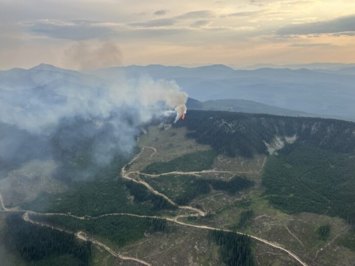
The BC Wildfire Service is responding to a wildfire ignited by lightning at Mount Neptune, located approximately 18 kilometres north of the City of Rossland and 16 kilometres southwest of the City of Castlegar.
“This lightning-caused wildfire started near the ridge top up on Mount Neptune and was discovered the evening of August 10th. It was showing some fairly aggressive fire behaviour and we had air tankers work on the fire very quickly.” said Kim Wright, Information Officer at the Southeast Fire Center.
“The air tankers blanketed the whole area with retardant and then we had crews on it first thing this morning and they are supported by two heavy lift helicopters.”
“Those two heavy lift helicopters are supporting ground crews by pocketing the area. Heavy lift helicopters have some of the highest capacity for for dropping water so they are supporting ground crews by cooling the fire’s edge and by keeping fire behaviour reduced”
“We have two initial attack crews and a response officer working on it currently.”
The helicopters are actively bucketing water from the Nancy Greene Lake for this fire.
BC Wildfire services is asking boaters and recreators in the area to maintain an awareness of their surroundings and keep away from areas where helicopters are operating.
“Flying is a high risk activity and people on watercraft who try to get an up close look at these aircraft do present an increased safety risk for everyone in the area and that winds up interfering with our ability to fight a fire or practice safely.” said Wright.
“We do understand that people want to be out and this is a popular lake so we are trying to support suppression efforts on this fire, while also minimizing the amount of disruption to people in the area.”
This fire is visible from Highway 3 and Highway 3B and is not currently threatening structures or infrastructure, however, it is still out of control and has burnt over 6.5 hectares.
Where to find information
The BC Wildfire Service is the primary source of information for all wildfire activity.
Regional District Central Kootenay (RDCK) is the primary source of information for evacuation orders and evacuation alerts.
Drive BC for all information on roads and road closures.
Be the first to know! Don’t miss out on breaking news and daily updates in your area. Sign up to MyKootenayNow News Alerts.


